
Trasforma le intuizioni dell’IA in azioni concrete

Tendenze
Categories
Invisible Volcanic Ash Poses Deadly Risk to Aircraft Engines
Invisible Volcanic Ash Poses Deadly Risk to Aircraft Engines
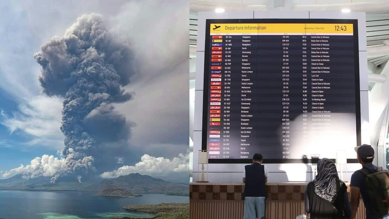
Volcanic ash, often imperceptible to the naked eye due to its fine and dispersed nature, presents a significant and sometimes underestimated hazard to aviation. Recent eruptions, notably from Mount Anak Krakatau in Indonesia and Mount Etna in Sicily, have highlighted the dangers posed by invisible ash clouds, which can lead to sudden and catastrophic engine failures without warning.
Recent Eruptions and Aviation Disruptions
On June 9, 2026, Mount Anak Krakatau erupted, dispersing ash over the skies above Jakarta and prompting the temporary closure of several airports, including Soekarno-Hatta International Airport. The Meteorology, Climatology, and Geophysics Agency (BMKG) detected ash at altitudes reaching 20,000 feet (6.1 kilometers) over Java and as high as 50,000 feet (15.24 kilometers) over Sumatra. Satellite imagery identified two primary ash clusters: one extending from the surface to 20,000 feet, moving northeast to south and affecting regions such as Banten, West Java, DKI Jakarta, and adjacent waters; and another reaching up to 50,000 feet, moving southwest to northwest, impacting Banten, Lampung, Bengkulu, the southern Sunda Strait, and the Indian Ocean.
In Jakarta, ash at lower altitudes infiltrated the capital’s airspace. BMKG Deputy for Meteorology Andri Ramdhani explained that routine paper tests at affected airports confirmed volcanic ash fallout at four locations, leading to recommendations for airport closures issued to the Ministry of Transportation. Continued monitoring indicated that these closures might need to be extended as conditions evolved. For travelers, this translated into widespread delays and cancellations, while for aviation authorities, such measures were vital to ensuring safety.
Similarly, Mount Etna’s recent activity forced the closure of Catania Airport in Sicily, underscoring the persistent challenges volcanic ash poses to air travel across different regions.
The Enduring Threat of Invisible Ash Clouds
The aviation industry’s awareness of volcanic ash dangers was profoundly shaped by the 1982 incident involving British Airways Flight 009. While cruising at 37,000 feet over West Java, the Boeing 747 inadvertently entered an ash cloud from Mount Galunggung. The ash caused all four engines to fail as it melted and adhered to engine components. The aircraft plummeted 25,000 feet before the crew successfully restarted the engines and landed safely in Jakarta. This event remains a pivotal moment in understanding the lethal risks of volcanic ash to aircraft.
Unlike visible weather phenomena such as storms or turbulence, volcanic ash clouds can be virtually invisible, leaving pilots with little to no warning before encountering them. This invisibility significantly increases the risk of engine damage and failure. The recent disruptions in Indonesia and Sicily serve as stark reminders of the ongoing threat volcanic ash poses to global aviation.
As volcanic activity continues to affect air travel, the imperative for vigilant monitoring and swift response mechanisms remains critical. These efforts are essential not only to safeguard passenger safety but also to maintain the integrity of global air connectivity amid evolving challenges in the aviation industry.
Etihad Airways Suspends Airbus A380 Flights on Key Route

Aditya Birla Group Seeks Approval for Aircraft Leasing in GIFT City

Qatar Airways Highlights Innovation and Connectivity at Arabian Travel Market 2026
Hong Kong's Five-Year Plan Includes Andrew Fan's Aircraft Parts Processing Hub Proposal
ACIA Aero Leasing Delivers ATR72-600 to Air Nostrum
RTX Appoints Jill Albertelli as Head of Pratt & Whitney

TAT Technologies Joins Beyond Aero Hydrogen Aircraft Program

AURAK Study Highlights Barriers to Air Taxi Adoption in Emerging Economies

Xiamen Air Selects Altitude for 787 Maintenance at Heathrow
Etihad and Swissport Extend Global Partnership
